
These were our trips for 2017 as we advertised them. Please click on links below each to view a post trip summary.
Click here to see basic maps of the 2017 trips described below

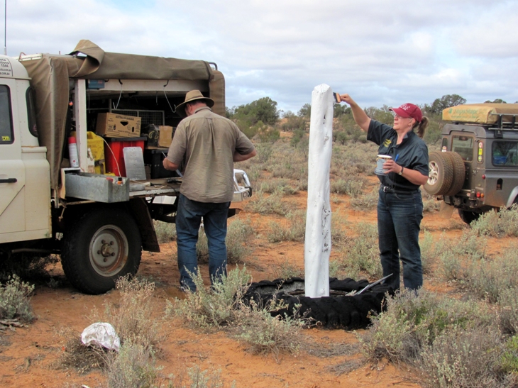

Mick & Connie - plaque maintenance
(copyright Patrick Sutcliffe)
** Please note -: Final itineraries for all trips are dependent on permit approvals **
OFF-ROAD TOUR
At the moment Connie & I have a loop planned in the area of Coober Pedy using a combination of station tracks & the Dog Fence. The majority of the tracks are not tourist routes so like the Nullarbor job it should be very quiet with no travellers, maybe just a few station blokes. Connie & I will find out about the route over the summer months, whether it is viable and if permissions are possible. We will even try and drive most of it so we can give a good estimate of fuel consumption etc. As this takes shape we will keep you informed of our progress.
 |
** Please read our post-trip summary ( for summary click here ) **
![]()
OFF-ROAD TOUR
** Please note -: this tour has been reversed due to Woomera Prohibited Area closures **
By the early 1960s, apart from a scattered network of Sandalwood tracks, the Great Victoria Desert, Australia’s largest, had no made road through it. Then in 1962 a surveyor, his wife and their baby daughter in a scarred and battered Land Rover carefully picked a path for a bulldozer & grader to follow. Two roads were then carved out of the virgin scrub by a small party of blokes, one east & west, the other north & south. That tiny road-making crew became famous for opening up the western deserts for the first time, they have become immortalised as the Gunbarrel Road Construction Party. Of course the surveyor was Len Beadell, his wife was Anne & the infant daughter was Connie. As they say in the classics, the rest is history......
More than fifty five years later the Great Victoria has changed little, an immense area some 6% of Australia’s landmass still lies virtually untouched. Len Beadell’s road network has endured the test of time and almost all of his tracks have now become famous as 4WD adventure trips for folk from all over the country, many of the roads have become household names.
Beadell Tours (Connie & Mick) are devoting 26 days towards travelling both. With local Aboriginal permissions the trip will include a variety of extra features & sites not normally seen by travellers. Anecdotes and diary entries from Len himself with journals & maps from the earlier explorers such as Giles, Hann & Lindsay will combine to offer a unique perspective of an environment unlike any other in the world.
If you want to travel safely and have the time to look around while learning as much as possible about the western desert this trip might be for you.
 |
Distances
** Please read our post-trip summary ( for summary click here ) **
![]()
 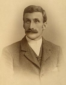 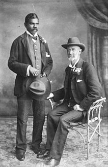 |
| David Carnegie Larry Wells Frank Hann (right) with Talbot |
OFF-TRACK EXPEDITION
There are a small percentage of people in Australia that have an intense interest in early Australian history. Most folks read books and research their favourite subject while looking at a map from the comfort of their home. There is a far smaller, you could say tiny, group of folk who actually go out into very remote country with the dust & flies and search for forgotten sites used by explorers, settlers & Aboriginals. Beadell Tours are part of that miniscule group of people who are comfortable in the most remote desert country Australia has to offer. We have been doing it for years.
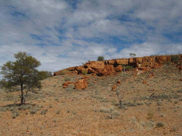
In 2017 we are focussing on part of Carnegie’s 1896 route as well as some of the 1892 Elder Expedition led by Larry Wells, Frank Hann also plodded through the same area early in the 1900s & we’ll have a look for some of Frank’s sites as well. The north west of the vast Great Victoria Desert is a mixture of landscapes; some sandhills, some undulations and quite a few isolated ranges and scattered hills. Hidden away in these features are the water sources the explorers found & used as they passed through. Obviously these places were very well known to the local people, the nomadic Aboriginals. Even now these features do not have roads or tracks to them so the only way to see & explore them is to travel across country through the bush the hard way. We anticipate 600-700 kms of off-track travel. The remainder will be a mixture of reasonable roads, good tracks and overgrown wheeltracks. This will be an extremely interesting trip for those keen on explorers, natural history, Aboriginal culture and doing something different.
Detailed maps of our intended route and other details will become available as the off-track navigation for the trip takes shape. If you have any questions drop us a line.
 |
Information will be supplied about off-track travel and
what is required to participate in a month long expedition.
These trips are unique and well worth the effort.
** Please read our post-trip summary ( for summary click here ) **
![]()
OFF-ROAD TOUR
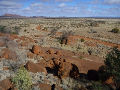
This tour is another in our series of trips with the main focus on the roads that Len Beadell & the Gunbarrel Road Construction Party built between 1955 & 1963. Connie relates the history of the road constructions as we travel, from copies of Len’s diaries and family anecdotes from the 1950s, 60s & 70s. A slow and relaxed pace will give everyone a chance to experience the changing desert environment and absorb the huge amount of history Beadell Tours has to offer.
Departing the busy iron ore hub of Newman we travel east on the last road Len & the boys made in 1963, the Windy Corner Road. Passing over the Canning Stock Route at Wells 23 & 24 we head into the sandhills & undulations of the Little Sandy Desert. Reaching Windy Corner we join the Gary Highway & turn south along the western edge of Gibson’s Desert. In this country Giles passed by in 1876 & Carnegie pressed through in 1896. Travelling through the Young Range we reach Everard Junction & the famous Gunbarrel Highway completed in 1958. Heading east along the Gunbarrel past Mt Beadell & other features we reach Jackie Junction. Running south down the new road alignment we cross the paths of Forrest in 1874 & Giles in 1873. Reaching Warburton we will have a relaxing day off from travel. On the move again, we continue east along the old Blackstone road through the heart of explorer country. Through Blackstone we re-join the Gunbarrel Highway & enter South Australia near the tiny Community of Kalka. Slipping along the edges of the Tomkinson, Mann & Musgrave Ranges we visit several Communities to see Aboriginal artwork from the painters themselves. Leaving the APY Lands we enter the Northern Territory & cattle station country. Passing Mulga Park & Victory Downs we reach the Stuart Highway and complete our tour at Kulgera Roadhouse.
Rockholes, plants, trees, birds and animals will bring the country to life and we have the time to see them. The entire region has an extraordinary amount of human history spanning thousands of years, a very thought provoking tour on many levels.
 |
** Please read our post-trip summary ( for summary click here ) **
![]()
(Require a pdf reader)
![]()
| Travel Information - general guide to touring with us |
| Vehicle Preparation - important basics |
| Road Conditions - what to expect |
| Tyre Information - detailed help regarding tyres, tubes and repairs |
| Vehicle, Koni & Communications - choices and help with common problems |
| Interest Pages - includes Len, Anne, Desert Articles & Updates plus Handy Links |
![]()
BEADELL TOURS
"Brinawa"
457 Nangar Road
CANOWINDRA, NSW, 2804
Phone : (02) 6344 1893
Mobile : 0408 841 447
Email : Beadell Tours
ABN : 40 947 959 130