![]()
These were our trips for 2011 as we advertised them. Please click on the links below each for a summary of facts & figures.
Click here to see maps of the 2011 trips described below
OFF-ROAD TOUR
The Canning Stock Route is without doubt the pinnacle of remote outback travel in Australia. Vast distances, various unique desert environments, extraordinary isolation and an almost direct link to our past both from a pastoral and aboriginal point of view.
Leading Surveyor A.W. Canning & Second in Command H.S. Trotman in 1906 began a Government survey for a stock route to bring cattle from the north of W.A. through the desert country to the goldfields. It was known the desert conditions would eliminate the tick problem that was restricting cattle movement between the north and south of the state. Canning and Trotman with crew of good men completed the survey from Wiluna to Lake Gregory, they then returned back to Wiluna in 1907 along the line of waters they had found that would in the next few years become the Canning Stock Route. Early in 1908 the Construction Expedition with more men, tonnes of gear, equipment and scores of camels to carry it all set out on what became a two year job to build and equip fifty one watering points across three deserts enabling travel through some of the harshest country on earth, quite simply one of Australia’s more remarkable achievements.
In the years before the stock route quite a few other notable fellows travelled the area as well, the Gregory brothers in 1856, Carnegie 1896, Warburton 1873, Hann 1897 & 1902, Giles 1876 and the Forrest brothers in 1874. These men left maps & journals of their travels and from them the maps we use today have in part been derived. Beadell Tours always feature a very high level of early explorer content, this trip will be no exception.
None of the above would have been possible without the help of local Aboriginals. Almost all of the stock route wells are situated on or near aboriginal wells, soaks or rockholes. Throughout this trip there are constant reminders of a long term Aboriginal presence. A great deal of time will be spent on this subject so a basic understanding of how people lived can be understood.
Later in 1963, during the last of Len Beadell's road making days, he re-discovered Wells 23 & 24 with these wells subsequently forming a part of his Windy Corner Road (Talawana Track). See Len's early photos, taken straight after he made his discoveries.
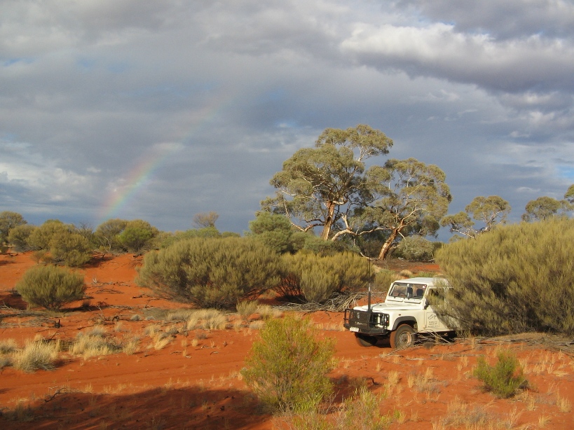
Beadell Tours are devoting 28 days towards travelling the Canning Stock Route, no rushing about from major centres, just Halls Creek to Wiluna. If you want to travel the Canning safely and have the time to look around and enjoy as much as possible this trip might be for you.
 |
| Canning Stock Route - Well 46 |
** Please read our post-trip summary ( for summary click here ) **
![]()
OFF-ROAD / OFF-TRACK EXPEDITION
For the last couple of years our expeditions have concentrated on exploring country not generally seen by 4WD travellers if by anyone at all for many years. This year we are concentrating on the south west of the western deserts. It’s a large area bordered by the Transcontinental Railway in the south, the Goldfields in the west and the Great Central Road in the north.
Most of this area was explored by Frank Hann between 1902 & 1908, but a few other fellows also feature, Forrest, Giles, the Elder Expedition and Carnegie, however being so close to the Goldfields the area was combed by many prospectors who have now been all but forgotten. Sandalwood harvesting had a large impact with many of the remaining tracks today being formed over the last 80 years for the use of transporting the valuable timber. Replacing sandalwood activity these days is the finding and extraction of minerals. Over the last few decades much of the western desert has been prospected and sampled for precious metals. Despite all this the south west still remains largely ignored, particularly by tourism.
The South West Explorer Expedition will be concentrating on unnamed hills and ranges as well as features that are known but not often seen. Several map features will also be investigated as we suspect they are incorrectly placed. In all we anticipate something around 500kms of off-track travel, the remainder will be a mixture of reasonable roads, good tracks and overgrown wheeltracks. With a lower amount of off-track travel we will have more time for longer camps and more exploration, a more relaxed adventure.
This will be an extremely interesting trip for those keen on explorers, natural history and doing something different.
If you have any questions drop us a line, maps of our intended route are also available.

** Please read our post-trip summary ( for summary click here ) **
![]()
OFF-ROAD TOUR
Beadell Tracks Wanderer is an extensive tour covering most of Len Beadell’s most famous roads. Connie relates the history of the famous road constructions from copies of Len Beadell’s diaries and family anecdotes from the 1950's, 60's & 70's. Mick goes into the details of various explorers, surveyors and adventurers who traversed the country we travel through. Names such as Giles, Tietkens, McKay, Hann, Lasseter, Forrest and Carnegie will feature during the trip. Three different western deserts are experienced, Gibson’s Desert, the Great Sandy Desert and the enormous Great Victoria Desert. Few places are left on Earth where such enormous areas are virtually untouched.
Departing Yulara, we head for the Rawlinson Ranges. Turning north we travel Len’s Sandy Blight Junction Road, rocky ranges, red sandhills and majestic Desert Oaks abound. From Sandy Blight Junction we turn west and the area where in 1960 Len’s ration truck burnt to the ground. Keeping westward on the Gary Junction Road we pass more Desert Oak forests and red sandhills indicating the southern edge of the huge Great Sandy Desert. Heading south from Gary Junction we 4wd along the Gary Highway, one of the least travelled of the Beadell Tracks network. Passing Windy Corner we continue south over the vast undulations of Gibson’s Desert. Arriving at Everard Junction on the Gunbarrel Highway, we turn east and make for Warburton. After a brief stopover we continue south on the Connie Sue Highway entering the Great Victoria Desert. Once at Neale Junction we swing west once again and follow the Anne Beadell Highway into the small mining town of Laverton.
A slow and relaxed pace will give everyone a chance to experience the intricate and ever changing desert environment. Rockholes, plants, trees, birds and animals will bring the country to life and we do have the time to see them. We average 4 hours of travelling per day that means we spend more time out of the vehicles than driving. A day off from travelling will also be in the itinerary so you can kick back. Our adventure concludes at Laverton in Western Australia.
 |
| Lake Cohen - Gary Highway |
** Please read our post-trip summary ( for summary click here ) **
![]()
OFF-ROAD TOUR
This Tour of the famous Anne Beadell Highway is timed for the wildflowers and the warmer weather of early spring. A relaxed pace will allow plenty of time for a memorable experience in a world unique environment. Stunning Marble Gum woodlands, huge salt lakes, towering red sandhills and dazzling white breakaway cliffs are some of the natural features along our route.
The Anne Beadell Highway runs through the middle of the Great Victoria Desert named by explorer Ernest Giles in 1875 after successfully crossing the vast area with camels, Giles and his men had travelled for 17 days between water sources. Giles couldn’t have known then that "The Great Victoria Desert" covered 6% of Australia’s land mass, the largest of our many and varied desert regions.
In the early 1950's Len Beadell started road making and surveying west of Coober Pedy for the British/Australian atomic testing. Over nearly a decade the Anne Beadell Highway took shape being made in sections for various purposes. Finally in 1962 the first east-west road through the Great Victoria was completed by Len and the now famous Gunbarrel Road Construction Party. Connie Beadell relates this history direct from her father’s diaries written at the time, a perspective only available from Beadell Tours.
Quite simply this is a visually captivating trip through a very special environment.
** Please read our post-trip summary ( for summary click here ) **
![]()
OFF-ROAD TOUR
Very little is done to promote the extensive Nullarbor region as a 4WD destination. Most folk hardly give it a thought at all. The Nullarbor is just that long boring distance between South & Western Australia. To change that opinion the solution is pretty simple, get off the bitumen......This tour travels from Nullarbor Roadhouse right across to Esperance in the west, and you guessed it, there will be virtually no bitumen.
The Nullarbor has a very long human history. Aboriginal occupation dates back tens of thousands of years, seafarers have been sailing past for 300 years, explorers began poking around from the 1840's, pastoral interests began in the 1860's, the Overland Telegraph Line sent it’s first message in 1877 and the Transcontinental Railway was completed in 1917. All of this history is still available to be seen and experienced, if you know where to look.
The first travellers on the Nullarbor were the aboriginals, following lines of rockholes and freshwater wells dug in the sand of the coastline. They moved about the region according to the seasons. Much later on these travel routes were used by the early explorers, pastoralists and eventually the roads continued the use of these ancient human pathways. It is a unique feeling these days to travel the same line as thousands of generations before you have done.
A great range of features and sites will be seen along the way revealing a vast intricate environment completely different to the deserts just to the north. Limestone caves both small and massive, blowholes, rockholes, relics of the early days and dozens of varieties of trees, shrubs and plants are just some of the sites the Nullarbor has to offer.
This will be a surprising trip at a relaxed pace with days off at interesting locations.
  |
| Overland Telegraph pole 1877 Erodiphyllum query acanthocephalum
|
  |
| Pannikin Plain Cave Coompana Rockhole |
** Please read our post-trip summary ( for summary click here ) **
![]()
BEADELL TOURS
Mobile : 0408 841 447
Email : Beadell Tours
ABN : 40 947 959 130